BitcheHD : apports du LiDAR HD à la compréhension des milieux enforestés
BitcheHD : contributions of HD LiDAR to understanding forested environments
2024
OHM Project
Bitche County OHM
Leader : Rochel Xavier
Project leader’s laboratory : LOTERR
Full address of laboratory : Campus Lettres - 23, boulevard Albert 1er 54000 NANCY
Keywords :
LiDAR
cartographie
inventaire
forêt
patrimoine
Disciplines :
Étude du passé humain
Abstract :
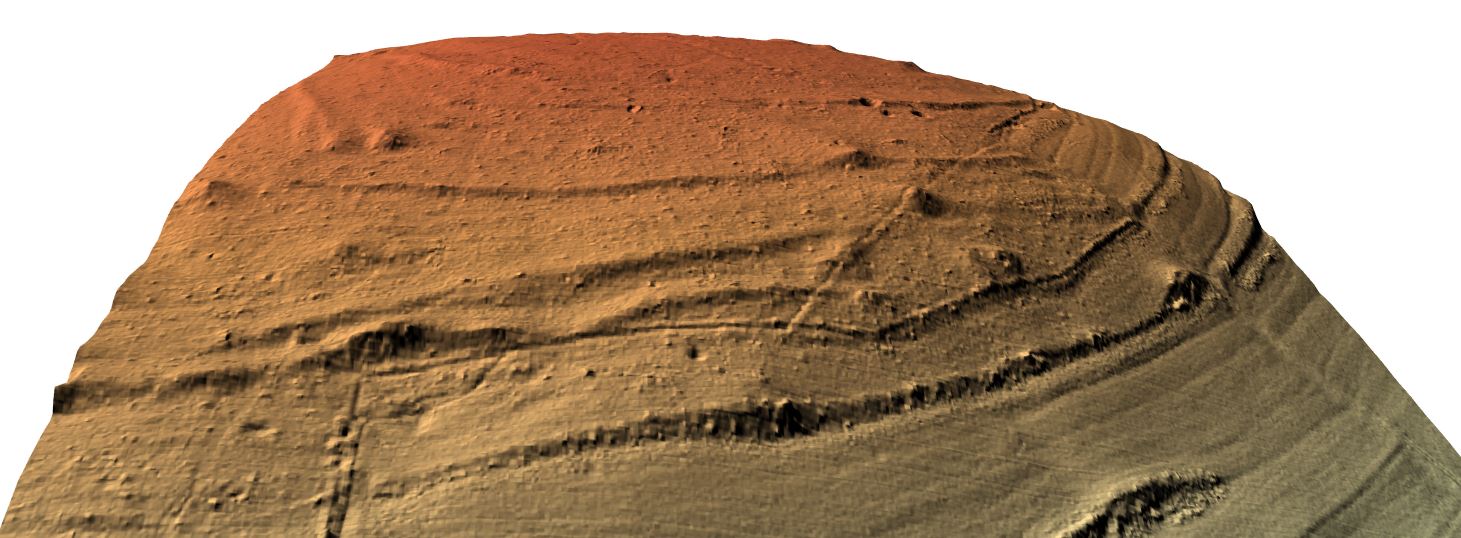
La mise à disposition du LiDAR HD par l'IGN en 2023 bouleverse brusquement les conditions des recherches relatives aux relations hommes-milieux, en apportant une source homogène, nationale, fiable, et de grande précision, là où l'on ne disposait que de données imparfaites et irrégulièrement localisées. De ce fait, il convient d'explorer ces nouvelles données et l'apport qu'elles pourront nécessairement représenter pour les problématiques abordées dans le cadre de l'OHM. Par une collecte et un traitement des MNT et ombrages issus de LiDAR, l'objectif premier de ce projet est de revisiter les inventaires de formes réalisés jusqu'ici dans les domaines relatifs aux forêts anciennes, aux charbonnières, au patrimoine militaire, sous couvert forestier. Outre cet apport de données nouvelles, ce travail permettra de mesurer l'apport du LiDAR HD par rapport à ce que permettaient les moyens antérieurs.
Translated abstract :
The provision of HD LiDAR by IGN in 2023 suddenly disrupts the conditions of research relating to human-environment relations, by providing a homogeneous, national, reliable and highly precise source, where we only had imperfect and irregularly located data. Therefore, it is appropriate to explore these new data and the contribution that they may necessarily represent for the issues addressed within the framework of the OHM. By collecting and processing DEMs and shadings from LiDAR, the primary objective of this project is to revisit the inventories carried out so far within themes relating to ancient forests, charcoal pits, military heritage, under forest cover. In addition to this provision of new data, this work will make it possible to measure the contribution of HD LiDAR compared to what previous means allowed.