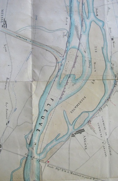
Original title (in French): Plan du cours du Rhône dans l'intervalle du village du Pouzin à celui de Baix, pour servir au projet de défense du territoire de ces deux communes. English title: Map of the Rhône river between the towns of Pouzin and Baix, to be used for the project to defend these two towns.
Auteur : Lagniol
Lat : 44.590990, Lon : 4.731386
Pour plus d'informations vous pouvez consulter la page de l'image sur photo.driihm.fr -> Lien